Small data, big difference: why satellite IoT could transform mountain safety
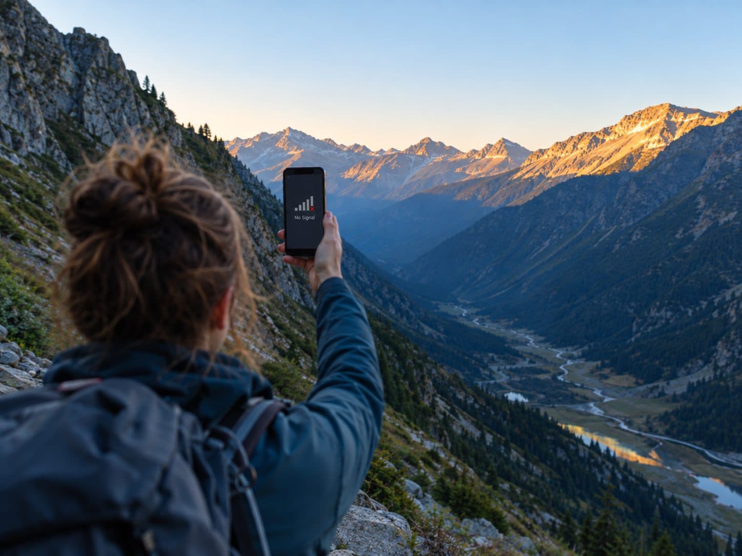
You don't need video streaming on a glacier when in danger. You need critical messages to get through any means when conventional networks disappear and to the closest person or service.
When people hear “satellite internet,” they often picture video calls from a summit or in any conditions. The physics is different than marketing images and connection depends on several conditions. Or like our friend Harald Naumann from Antennity said “Physics makes no compromises”.
Mountain safety has different requirements: a position, a check-in, a hazard warning, or an SOS message that can reach someone when ordinary mobile coverage is unavailable. That means low data, but we want to be able to send it in any conditions, any channel available, always connected if needed. The mountain safety graal! Grab a coffee and let’s dive in!
That is why Narrowband Internet of Things over Non-Terrestrial Networks (NB-IoT NTN) is an important development for hikers, ski tourers, trail runners, and anyone exploring beyond the reach of terrestrial networks.
For Outdoor Aficionados (OA), the opportunity goes beyond satellite connectivity alone. We are developing a hybrid communication and navigation solution combining terrestrial mobile networks, satellite connectivity, and a peer-to-peer LoRa mesh. The objective is to give outdoor users multiple ways to communicate, even in challenging terrain, all in one device, easy to use. However, we must first understand what is really possible and how it really works.
1. First, what is NB-IoT & NTN?
NB-IoT stands for Narrowband Internet of Things. It is a cellular technology designed for devices that send small amounts of data, such as water meters, parcel trackers, and environmental sensors. Rather than prioritising high data rates, NB-IoT focuses on efficient, low-power communication, making it suitable for compact devices that need to operate for extended periods.
NTN stands for Non-Terrestrial Network. With 3GPP Release 17, the mobile industry introduced standardised support for satellite-based IoT connectivity, allowing compatible devices to communicate through supported satellite networks. In Release 17, the satellite relays the signal to a ground station connected to the mobile network. Later 3GPP releases add the option of processing signals on board the satellite. Next step will be to standardise the NTN connectivity for seamless services and user experience.
The result is a new opportunity to combine established cellular technology with satellite connectivity, without requiring the bandwidth of a conventional smartphone internet connection.
2. Why small data makes a big difference on the trail
Think about what a hiker needs to communicate in the backcountry:
- Position: Where am I?
- Check-in: I'm at the top. Everything is fine.
- Hazard report: A bridge has been washed out, or a trail is blocked, wild fire on your way.
- SOS: I need assistance. Can’t move. Here are my coordinates and what has happened.
- Follow-up: My location or condition has changed.
These messages are tiny compared with a photograph or video. For illustration, a compact position or check-in payload might be around 30-45 bytes, a short text payload around 80-100 bytes, and a full sequence of emergency updates around 1-2 kilobytes. Actual sizes depend also on how to encode and the communication protocols.
Mountain safety is a connectivity and message-delivery problem.
The objective is to transmit the right information through the closest available communication path while managing energy consumption and cost. It can save precious time to be rescued, lower costs for the national services (less time to search) and it’s easier when a fellow hiker on the mountain can assist you in times of need.
3. A new generation of satellite IoT connectivity
Three developments make this approach particularly interesting.
Standards-based cellular and satellite connectivity
NB-IoT NTN builds on mobile industry standards, creating opportunities to combine terrestrial cellular and compatible satellite connectivity in the same device.
Nordic Semiconductor's nRF9151, for example, supports terrestrial cellular IoT and satellite NTN capabilities. This provides a technical foundation for devices designed to operate across different communication environments.
Multi-orbit connectivity
Geostationary (GEO) satellites orbit approximately 35,786 kilometres above the equator and remain positioned over the same region. Low Earth orbit (LEO) satellites operate much closer to Earth and move across the sky.
GEO systems can provide persistent regional coverage, while LEO systems generally offer lower propagation latency and may provide advantages in certain remote areas and at high latitudes. Both can be obstructed by mountain terrain. That’s why in deep valleys, canyons, under canopy or in bad weather, our satellite messengers are not working. Just physics and terrain reality.
Today's public NB-IoT LEO networks still provide discontinuous coverage: a device must wait for a satellite to pass overhead. Supporting multiple satellite systems can give a compatible device more opportunities to establish a connection under different conditions.
What's new: an emerging network of networks
In February 2026, Deutsche Telekom announced its multi-orbit IoT roaming offering, combining terrestrial connectivity with satellite services involving Skylo, Sateliot, and OQ Technology, with Iridium's NTN Direct service announced for business customers in the second half of 2026.
In September 2026, Deutsche Telekom's Multi-Orbit Early Adopter Program Participants Booklet identified OA among its main participants and listed Nordic Semiconductor, Sateliot, OQ Technology, Skylo, and Kyocera AVX among its technology partners.
This places OA within an ecosystem spanning cellular IoT hardware, satellite operators, and radio-frequency technology. It also reflects a broader industry direction: connecting devices across terrestrial and non-terrestrial networks through increasingly integrated services. Participation in the early-adopter program provides an opportunity to explore and evaluate these capabilities as the technology develops.
4. Our approach: mobile, satellite and radio mesh
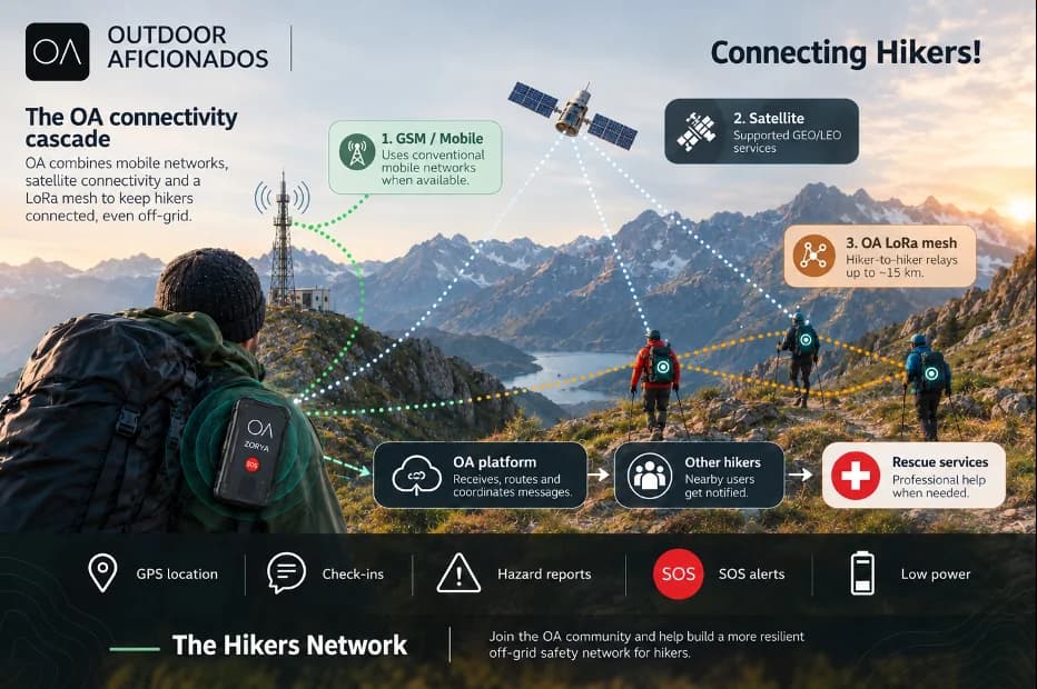
We are developing an all-in-one communication device, we call it Zorya and a native navigation app for outdoor users. Think Starlink meets Waze with social features and an environmental impact hike-to-purpose model. Its architecture combines GSM/cellular connectivity, satellite communication, and a LoRa mesh intended to relay messages between compatible devices.
The system follows a connectivity cascade, using the most suitable available communication path.

Concept illustration: the OA connectivity cascade. Escalation to rescue services will run through a professional response-centre partner, currently being selected.
- Terrestrial mobile network. When cellular coverage is available, the device uses the conventional mobile network to communicate.
- OA LoRa mesh. When direct connectivity is obstructed, compatible OA devices can relay messages between hikers until a device with an external connection becomes reachable. Every hiker is a node for everyone else. A real safety and communication network.
- Satellite connectivity. When terrestrial coverage disappears, compatible satellite IoT services can provide another route for essential messages, including supported GEO or LEO options.
The mesh creates the possibility of extending communication beyond the range of any single device's direct connection. Our goal was to be able to announce anyone in range of up to 15 kilometres (approx. 2-4 h of hike) and to have one device with resilient ways of communications.
The core principle is resilience through multiple communication paths. If one route is unavailable, another may offer a way forward.
5. Beyond connectivity: building a connected hiking community
We aim to connect hikers with one another through communication, navigation, and shared outdoor information.
Our concept includes:
- SOS proximity: Alerting relevant nearby users to an emergency.
- Hiker-to-hiker communication: Sharing messages beyond conventional mobile coverage.
- Hazard reporting: Sharing information about rockfalls, damaged bridges, blocked trails, and other local hazards.
- Navigation: Combining communication capabilities with a native navigation app.
- Community participation: Supporting OA's “hike-to-preserve” and “hike-to-earn” initiatives.
The goal is to make outdoor users not just recipients of information, but potential contributors to a more connected hiking community and a safer environment.
6. SOS alerts: connecting people when it matters
When a hiker triggers an SOS, the OA system is intended to communicate the incident and location through available network paths. Nearby OA hikers will be notified, helping people in the vicinity become aware of an emergency while professional assistance is organised.
Community notifications and professional rescue coordination remain distinct steps. To handle the professional side, OA is currently selecting a service partner: a 24/7 emergency response centre that can receive SOS alerts and escalate them to the appropriate rescue services. A dependable emergency workflow also needs delivery acknowledgements, retry mechanisms, and clear information about whether an alert has reached its intended recipient.
The same communication architecture can support timely local hazard reports, helping hikers make informed decisions before reaching dangerous conditions.
7. Why we are developing the hikers network
Founded in 2024, Outdoor Aficionados is a startup with offices and teams in France and Romania. It focuses on off-grid communication and navigation for outdoor environments, with an emphasis on safety, community and environmental impact.
Its product concept combines GSM/cellular, satellite connectivity (GEO and LEO), and a LoRa mesh in a self-healing communication device, paired with a native navigation app.
The ambition is straightforward: hikers should not need to understand radio networks or satellite orbits to benefit from a useful, easy to use and affordable device. The technology should manage communication paths in the background and make it easier to share essential information outdoors.
8. What this means for hikers
For hikers, combining mobile, satellite, and mesh connectivity could reduce dependence on any single communication network. For mountain safety, the value lies in bringing these capabilities together with navigation, SOS alerts, and community-generated hazard information.
Explore. Navigate. Communicate. Join the OA community and help build a more resilient off-grid safety network for hikers.
Sources and further reading
- 3GPP — Non-Terrestrial Networks overview
- Nordic Semiconductor — nRF9151 NTN technical documentation
- Nordic Semiconductor — nRF9151 development kit and NTN evaluation
- Deutsche Telekom — Multi-orbit IoT roaming, February 2026
- Deutsche Telekom IoT — Multi-Orbit Early Adopter Program Participants Booklet, September 2026
- Harald Naumann — Why the 5G NTN LEO satellite connection is failing on the horizon